|
|
|
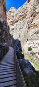
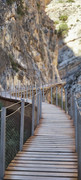
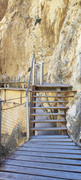
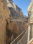
Once known as the most dangerous hike in the world, El Caminito del Rey in Malaga was reopened in 2015 with a new, safe walkway pinned along the 100-meter tall vertical cliff-side.
It’s now accessible for anyone that can handle vertigo that follows along the jaw-dropping path.
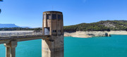
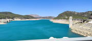
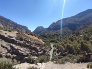
The Caminito is situated in a Natural reservoir, once plenty of mines and hydroelectric basins
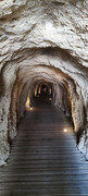
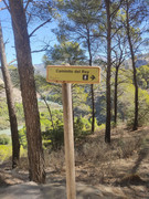
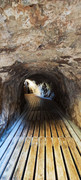
From this point (the tunnel), you still need to allow yourself 30 minutes before your time slot as this is NOT the start of the Caminito del Rey. It’s a 2.5 km scenic walk through forest to reach the starting point which will take 30 minutes at least.
Once at the starting point there were already loads of people waiting and there are staff to check your tickets, give you helmets and put you in the correct group. There are a lot of people that are part of guided tours which you can also book through the website, the tours are in English and Spanish.
Next they separate people into English and Spanish speakers for a brief safety instruction where the guide told us to allow around 2.5 hours to complete the walk, then you are off on your way.
You can easily hike El Caminito del Rey all year round, but if you can avoid the hottest months of July to mid-September, I recommend moving your dates. Though large parts of the trail are in the shade, it can be scorching hot, and there are no places to go for a swim during the walk.
 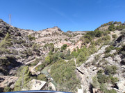 
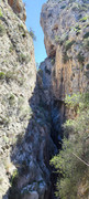
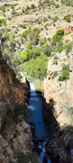
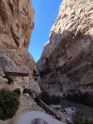
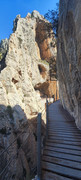
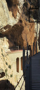
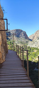
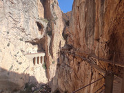
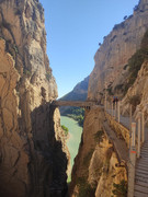
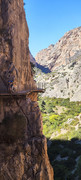
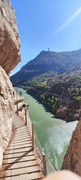
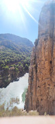
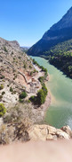
The Caminito del Rey route is spectacular from beginning to end, running through cliffs, canyons, and a large valley. It crosses the landscapes of Desfiladero de los Gaitanes, a gorge carved out by the river Guadalhorce, with walls 700 metres high. The area is also inhabited by a wide variety of plant and animal species
Why is it called Caminito del Rey?
This unique aerial path, suspended 100 metres up against the walls of the gorge, originates in the early 20th century. It was built between the waterfalls of Gaitanejo and El Chorro to bring materials and maintenance workers to the local hydroelectric dam. In 1921, King Alfonso XIII officially opened this feat of engineering, taking the walkway to the Conde de Guadalhorce dam, and since then it has been known as “the King’s little walk” - Caminito del Rey.
    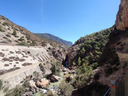
    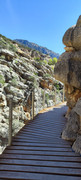 
The trail is linear and taken one way only, going downwards and from north to south, some of it on mountain paths and some on suspended walkways. It’s 7.7 kilometres long and takes about 3-4 hours to walk, from the start in the town of Ardales to the exit in Álora. The reception area at the start has a restaurant and several parking areas, and is also the final stop of the shuttle bus which runs between the north and south ends of the trail.
|
|


 .
. .
.